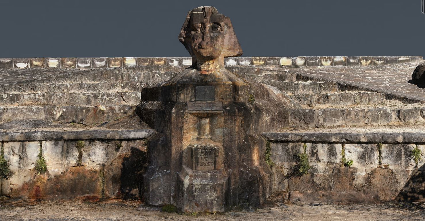
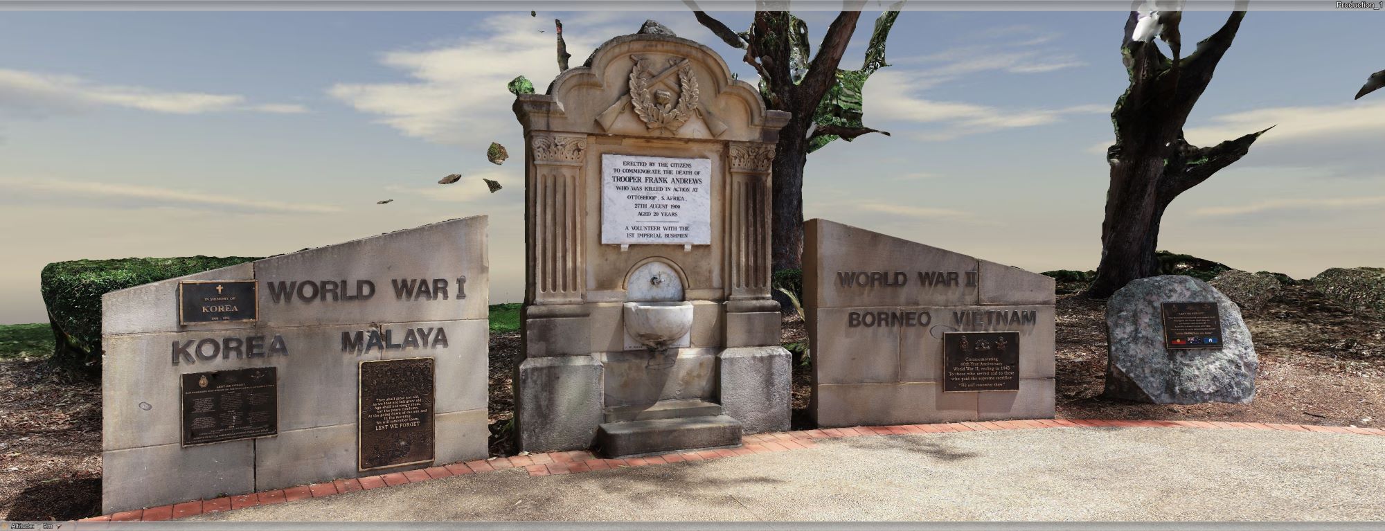
South Coast Sphinx Memorial & Wollongong Cenotaph 3D capture
Services
Contact point

NSW Public Works took detailed 3D captures of Wollongong Cenotaph and Sphinx Memorial in Ku-ring-gai Chase National Park, supporting efforts to fully restore the ageing assets.
Background
In NSW there is a rich heritage of over 3,000 war memorials, encompassing monuments, buildings, plinths, plaques, and honour rolls, which hold special significance, either in terms of their physical presence, cultural importance, or vulnerability in their current environment.
Collaboratively, the NSW Office for Veterans Affairs, National Parks and Wildlife Service, and NSW Public Works (NSWPW) are actively exploring the application of advanced survey technologies to enhance the 3D spatial data capture of these War Memorials.
The primary goal is to comprehensively document the 3D attributes of these sites. This effort promises substantial benefits, including comprehensive archival records, the establishment of an integrated Asset Management Policy, and a valuable resource for future restoration programs.
This forward-thinking initiative underscores our commitment to preserving and honouring the historical significance of these memorials. By harnessing state-of-the-art survey technology, we are ensuring that their legacy endures for generations to come.
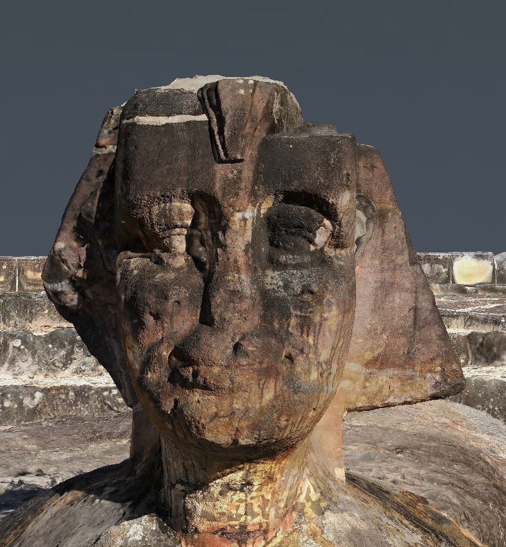
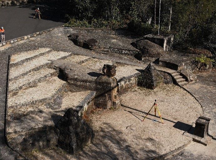
Sphinx Memorial key project facts
Reality model
- Date of Capture: 19 June 2023.
- Captured with DJI M300 RTK.
- 1489 photos.
- 5 Ground Control Points.
- Total Flight Time: 72 minutes.
Laser scanning
- Date of Capture: 19 June 2023.
- Captured with Leica RTC360 Laser Scanner.
- Number of Scans: 18.
- 5 Ground Control Points.
- 391.6 million points.
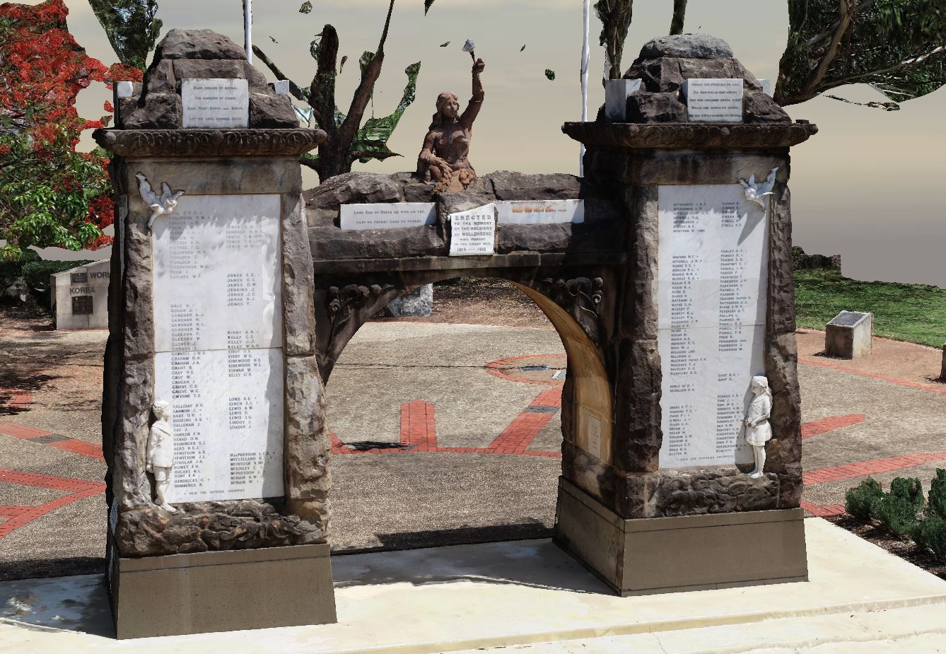
Wollongong Cenotaph key project facts
Reality model
- Date of Capture: 15 February 2023.
- Captured with DJI Phantom 4.
- RTK 807 photos.
- 4 Ground Control Points.
- Total Flight Time: 59 minutes.
Laser scanning
- Date of Capture: 15 February 2023.
- Captured with Leica RTC360 Laser Scanner.
- Number of Scans: 20.
- 4 Ground Control Points.
- 276.7 million points.
Our role
The NSWPW Surveying and Spatial team possesses both the expertise and specialised equipment required for scanning these assets. We employ cutting-edge technology, including drones and terrestrial laser scanners, to remotely create a 3D hyperreal, virtual model of these memorials.
Our team successfully conducted the capture process in June 2023. This operation involved a small, highly skilled team that not only managed the drone capture, but also performed critical tasks such as hazard spotting, surveying, and laser scanning.
Our collective efforts ensure the accurate and comprehensive documentation of these invaluable historical assets.
Outcomes
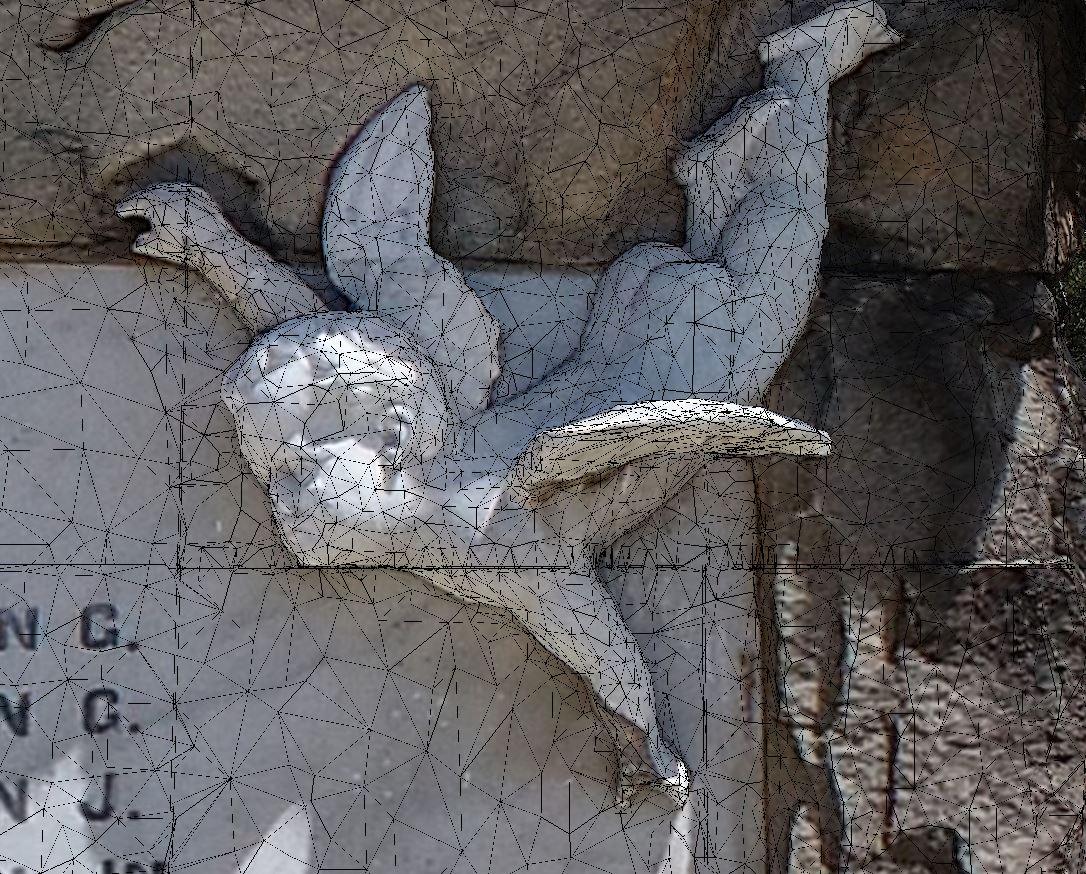
The survey that was conducted provided a wealth of valuable information. Firstly, it provided us with high-resolution imagery, offering a detailed visual portrayal of the war memorials, capturing every detail and nuance. Secondly, and equally significant, it furnished us with survey-accurate 3D point cloud data.
This 3D point cloud data serves as the cornerstone for constructing a sophisticated 3D digital twin model. This model served a twofold purpose: it acted as a comprehensive archival record, preserving these historical assets in an incredibly detailed virtual form. Additionally, it opened the door to future asset management endeavours, enabling us to plan and implement preservation, restoration, and maintenance efforts with unparalleled precision.
The combined value of these data sets could not be overstated. They not only preserve the heritage of these memorials but also provide an invaluable resource for informed decision-making in the management of these cherished assets.